Farmers in Nyeri have been advised to exercise patience as the country awaits the onset of the much-anticipated El Nino rains.
The weatherman had advised Nyeri residents to prepare for the start of the rains beginning this week in a report that was released in August.
But days into the second week, the county has yet to experience a single drop of the much-awaited rain.
But County Director of Meteorological Services, Mr. John Muiruri, has told farmers in the county not to panic owing to the seeming delay of the rains but to continue preparing their lands in readiness for planting.
He similarly said the delay is normal, and therefore even those who have already planted should not be worried about losing their seeds as the expected rains would be more than enough.
“You know it (rains) can have a little delay, but we had an update for the second and third weeks (of October). So I think it’s not very far, and anytime it can start raining,” he told KNA.
Last month, Muiruri briefed the media that parts of the county were expected to receive up to 600mm of downpour during the first and second weeks of October, and therefore there was an urgent need for preparation for such unforeseen occurrences as storm waters, floods, and landslides.
He further disclosed that some parts of the county, like Kieni East, would receive up to 600mm of rain while others, like Othaya, Mukurwe-ini, and Nyeri Central, would receive between 500 to 600 mm of rain.
Among the areas expected to receive the least amount of less than 300 mm of rain are Mathira and Mugunda wards in Kieni West.
“Caution is needed, as we are going to have enhanced rainfall, so preparedness is very important. They (both the county government and residents) have to prepare adequately in all the sectors, like roads and lands, in matters of soil erosion. We have to prepare because the rains are more than what we get,” he told KNA.
Muiruri nevertheless downplayed the extent of destruction to be expected from the rains, assuring residents it would pale in comparison to what was witnessed in 1997.
He was also quick to challenge farmers to take advantage of the rains by putting as much of their land under food crops to cushion them against unforeseen times.
But when KNA pressed him to shed some light on why the rains were taking longer than had been predicted, the official downplayed the fears, insisting that some parts of Western Kenya have already started receiving the rains.
He also said that, just like the normal seasonal rains, the El Nino phenomenon would not be instantaneous but gradual before picking up in intensity as the days progressed.
“It is not true that the El Nino rains have totally failed. There are areas like Western Kenya where the rains have already started. But you know that rain has to start gradually, so farmers should not be worried. Rains are coming,” stated the official.
According to a Kenya Meteorological Department (KMD) report dated August 30, 2023, the climate outlook for the October–November–December period indicates the whole country is likely to experience enhanced rainfall, a departure from what has been the norm for the last few years.
The high precipitation will be driven by warmer than average sea surface temperatures (SSTs) over the central and eastern equatorial Pacific Ocean, indicating the presence of El Nino conditions.
Nyeri is one of the counties expected to experience heavy rains throughout the three-month cycle.
According to the report, “Highlands east of the Rift Valley, Nyandarua, Nyeri, Kiambu Kirinyaga, Murang’a, Meru, Embu, Tharaka Nithi, Nairobi, and the eastern parts of Laikipia will likely experience rainfall throughout the season. Rainfall amounts are expected to be above the season’s long-term average,” says the report.
“The rainfall is expected to be well distributed in both time and space,” continues the outlook.
Heavy continuous rainfall is also expected in the Lake Victoria Basin region, Kisii, Elgeyo Marakwet, Bungoma, Trans Nzoia, West Pokot, Vihiga, Laikipia, Nakuru, and Narok counties.
The rains will begin in September before picking up in October and will prevail until January.
In the north-western counties of Turkana, Marsabit, and Samburu, the Met Department announced that rainfall above the long-term average for the season is expected.
“In the highlands east of the Rift Valley, Nairobi included, rainfall is expected throughout the season above the season’s long-term average. The rainfall will be well distributed in terms of space,” says the weather report.
In the lowlands, above-long-term average for the season is expected, while in the north-eastern counties, occasional rainfall of an amount slightly above average for the season will be experienced.
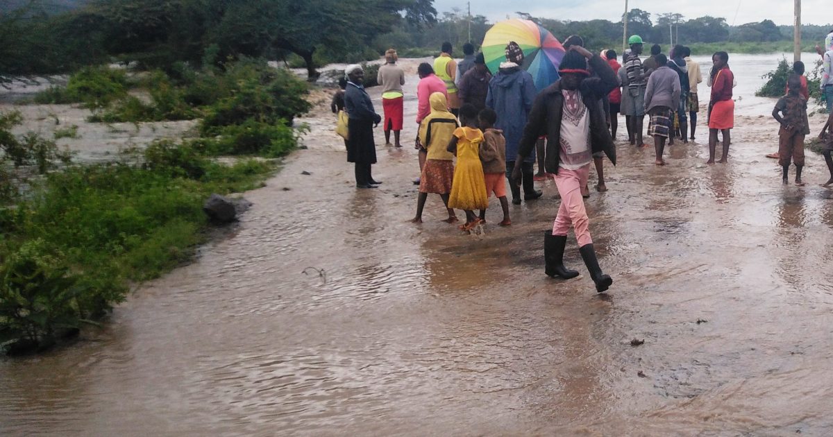
Wajir and Mandera counties will get the highest rainfall, which will be occasioned by widespread flooding.
Other areas likely to experience flooding include Nyakach, Nyando, the lower areas of the River Nzoia, the Winam Gulf, and the lower areas of the River Sondu in western Kenya.
In the Rift Valley region, floods are expected to occur in Gilgil, Narok town, and Suswa, while the coastal towns of Mwatate, Tana River Delta, and Mwatate have also been identified as high-risk areas.
Kenya experienced one of her most memorable El Nino phenomena in 1997, followed by similar ones in 2006, 2015, and 2019.
However, the 1997 El Nino rains were conspicuously enhanced due to a high positive El Nino and Indian Ocean Dipole (IOD) index, which stood at 2.6.
This year’s phenomenon is expected to be different due to its low El Nino index, which stands at 2.0.
During El Niño, the SSTs over the central and eastern Pacific Ocean become warmer than usual, while the SSTs over the western part of the ocean become cooler than usual.
On the other hand, the IOD is defined by the SST gradient between the western and eastern parts of the Indian Ocean.
“In 1997, both the El Nino index and Indian Ocean Dipole were all positive, so the combination of the two produced lots of rain, unlike in 2006, when it was an El Nino year but the Indian Ocean Dipole was not positive. So we didn’t have a lot of rain. The same case happened in 2015. This year, both the El Nino and Indian Ocean Dipole are positive, so we expect enhanced rainfall. But again, the strength will not be as great as what we experienced in 1997,” he explained.
On July 4 this year, the United Nations Meteorological Organisation warned the world to prepare for the adverse effects of El Nino, saying the weather phenomenon that triggers higher global temperatures would persist throughout this year.
El Nino is a naturally occurring climate pattern typically associated with increased heat worldwide, as well as drought in some parts of the world and heavy rains in other parts.
El Nino is the large-scale warming of surface temperatures in the central and eastern equatorial Pacific Ocean.
It usually occurs on average every two to seven years and lingers for a period of nine to 12 months.
“The onset of El Nino will greatly increase the likelihood of breaking temperature records and triggering more extreme heat in many parts of the world and in the ocean,” warned World Meteorological Organisation secretary-general Petteri Taalas.
“The declaration of an El Nino by the WMO is a signal to governments around the world to mobilise preparations to limit the impacts on our health, our ecosystems, and our economies,” said Taalas.
El Nino events are typically associated with increased rainfall in parts of southern South America, the southern United States, the Horn of Africa, and central Asia.
Kenya last experienced the El Nino phenomenon in 1997, resulting in exceptionally heavy rainfall and deadly floods.
The consequent El Nino in 2015 had a higher index but led to lower rainfall, causing less significant effects than had been anticipated.
By Samuel Maina


