The untapped potential of Wajir County resources is immense. With a population of 781,263 persons as per Kenya Peoples and Housing Census (KPHC) of 2019 for an arid and semi-arid area covering an area of 56,685.9 Km2, Wajir County is located in the North Eastern region of Kenya.
Wajir borders Somalia to the East, Ethiopia to the North, Mandera County to the Northeast, Isiolo County to the South West, Marsabit County to the West and Garissa County to the South.
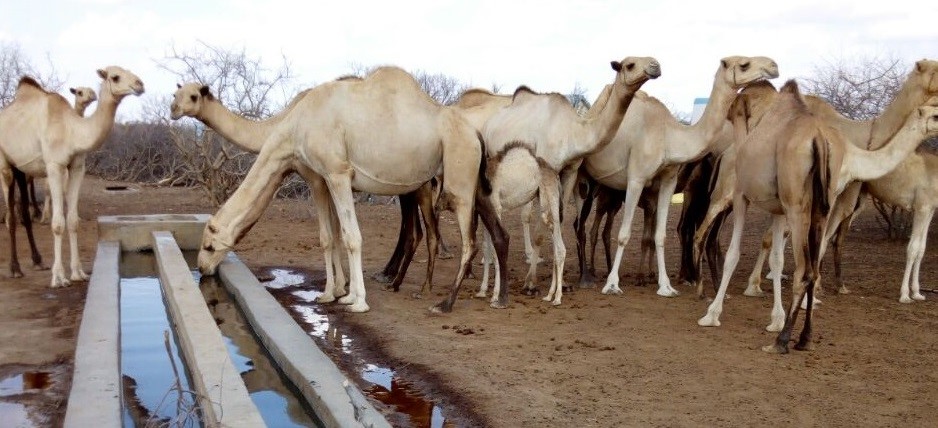
Livestock production under extensive pastoralist system is the dominant economic activity in the county with oover 80 per cent of the population dependent on livestock for their livelihoods and food security.
Livestock production also accounts for 75 per cent of employment in the rural set up, earning the County approximately sh.10.5 billion from Livestock and livestock products annually, Acting County Secretary Abdullahi Hassan Maalim reveals.
According to the Kenya National Bureau of Statistics (KNBS) 2019 animal census, there are about 1.2 million camels, 0.9 million cattle, 2.1 million sheep, 3.1 million goats, donkeys and chicken.
“Another sector with huge potential for the County is power generation. The entire County enjoys abundant sunshine throughout the year, with vast tracts of land devoid of vegetation appropriate for massive solar power generation, adds the County Secretary
In addition, select areas like the semi-arid lands of Habaswein in Southern Wajir and the bare terrain bordering the Chalbi desert bordering Marsabit County are reputed to have the greatest wind-speeds in the world which are suitable for renewable energy generation, reiterated Abdullahi Hassan.
There is an abundance of underground aquifers and shallow wells with yet to be quantified water reserves, with ongoing exploration and exploitation, says Abdullahi.
The Wajir County Government Website identifies the Eastern part of Wajir as being covered with naturally growing thickets and forests that yield the largest quantities of gums and resins which if processed in Kenya can sustain more than half of the world’s needs.
The gum and resins are majorly used as ingredients in manufacture of sweets and perfumes.
In addition, the entire county sits on huge deposits of untapped limestone with ongoing exploration for commercial viability for manufacturing cement and other by-products.
Wajir borders, and is central to, Marsabit, Mandera, Garissa and Isiolo areas that will be covered by Lamu Port Southern Sudan Ethiopia Transport (LAPSSET) corridor project.
In the project’s blueprint, Wajir County will be accessible through the areas of Nunu and Modogashe, which will be covered by a major tarmacked International trunk road which is expected to open up the county for business and leisure travel interconnecting the various neighbouring sub-counties.
“With abundant wildlife including giraffes, antelopes, ostrich, warthogs, a variety of dry region snakes, and renown scavengers such as the hyena and fox and top notch predators such as lions, leopards, our border with the Ewaso-Ngiro basin as well as the Sarova Shaba tourism sanctuary, the county has untapped opportunities for tourism exploration and exploitation”, noted Wajir Deputy County Governor Ali Ahmed Mukhtar.
Other potential tourist spots include Lake Yahud on the outskirts of Wajir Town, Wagalla massacre memorial site in Wajir West, Wajir Museum and World War-Two era fortifications including bunkers and underground tunnels constructed by both the British and Italians combatants at Orahey grounds, added the Deputy Governor.
by Donald Ngala


