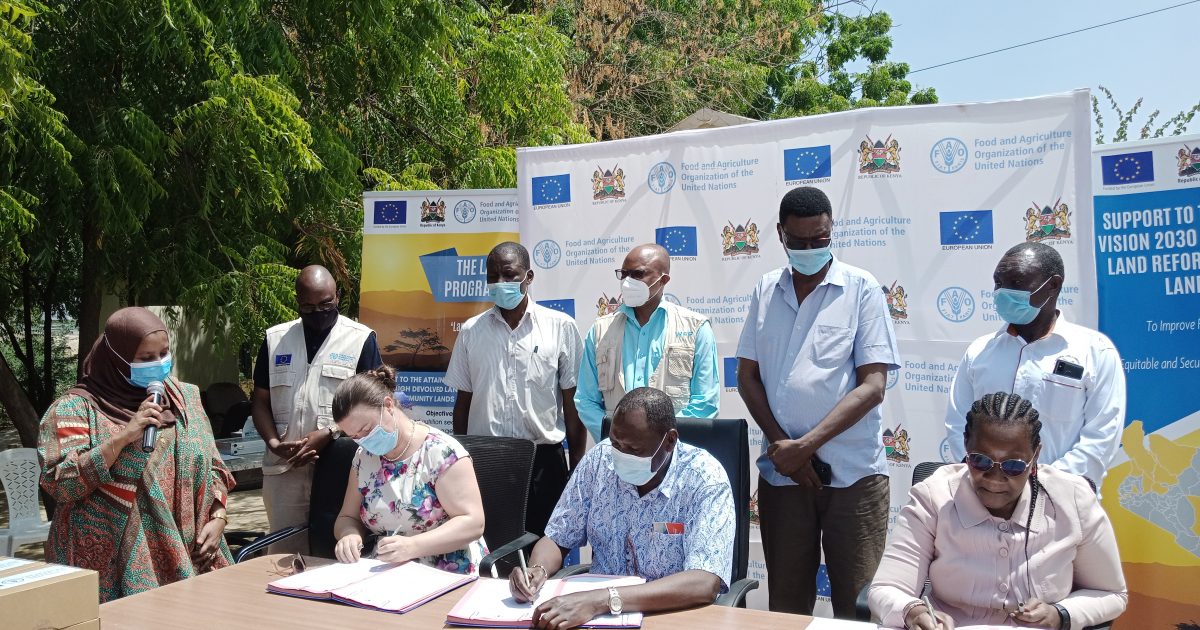
Turkana County administration is set to register Community Land after receiving survey and mapping equipment from the Food and Agriculture Organization through funding by the European Union.
The equipment received includes Global Positioning System (GPS), Geographical Information System (GIS) and plotter machines.
EU acting Ambassador to Kenya Katrin Hagemann and FAO Country Representative to Kenya Carla Mucavi handed over the equipment to the Chief Administrative Secretary (CAS) in the Ministry of Lands and Physical Planning Alex Muiru.
Speaking during the handover ceremony on Friday, the CAS thanked the EU and FAO for their support towards digital land registration of Arid and Semi-Arid Lands (ASALs) in Kenya.
Muiru acknowledged the significant step made by the Ministry towards decentralization of land administration services in the country, adding that the Ministry is committed to facilitating land registration services through digitization, national titling, institutional and land reforms.
“We initiated the process of digitization in 2018 and the President launched the online land transactions in Nairobi Land Registration Unit on 27th April, this year. National Land Management System is important in facilitating online land services for efficient and good governance,” Muiru said.
He said that the Community Land Act 2016 will guide the process because it is the relevant legislation applying to ASALs especially in Turkana where pastoralism is practised. He added there is need to understand the needs of the community with regard to land use.
“We cannot afford to sub-divide that land so much because they are likely to lack grazing grounds, we have to apply an understanding that they have a way to move from one point to another to look for water and other things,” Muiru said.
The CAS urged the County government to help map out those areas that need not to be included in the inventory for registration, so that the pastoralists may not be affected by the process.
Muiru said the Ministry will allocate resources to digitize Turkana land registration process once it is fully registered and fully operationalized through the support of EU and FAO.
He assured individuals owning plots they will get titles once the land registration is complete adding that a land registrar would be deployed to Turkana to enhance service delivery unlike the current situation where the land registration services are sourced from West Pokot County.
The acting European Union Ambassador to Kenya Katrin Hagemann said the handing over of equipment and opening of the land registry in Turkana is part of the EU support to FAO for the last four years in supporting land governance in the eleven counties of Laikipia, Tana River, West Pokot, Baringo, Marsabit, Samburu, Vihiga, Nandi, Nairobi, Kiambu and Kilifi.
She said the equipment handover was a milestone that would benefit land users and administrators through access to land related information, increasing investment, security of land tenure, favilitate access to loans with land as collateral, increase revenue through taxes, creation of job opportunities among others.
“It has been incredibly important from the very beginning in ASALs counties in Kenya, it was our focus in supporting devolution and this is something the EU believe in that things are done as close to the people as possible and that is why we were interested to support land governance project,” said Hagemann.
She underscored the significance of the project in resolving land related conflicts to promote investment and reduce corruption with regard to land ownership. She said conflict is minimised when there is clarity and identity of who owns the land and clearly distinguished boundaries.
FAO Country Representative Carla Mucavi said the long-standing partnership with the EU has contributed to the achievement of tangible results including the implementation of land governance programmes to support Kenya’s Vision 2030.
Mucavi said the move is a historical one because the land registry equipment will facilitate and improve the services provided to the community in terms of land registration, titling, access to land and land tenure.
She noted that food security and nutrition is the first priority and mandate of FAO and added one cannot produce food without access to secure land.
The FAO Representative advocated for the rights of women in the society to own land to increase production and enhance food security.
“If you have land that is really secure, if you have access to land, and women also have the right to own land, all these factors combine to really take this county to the next level,” she said.
National Land Commission Deputy Director for Land Rights Monitoring Samuel Ondari said land registration is intended to provide security of tenure, inspiring communities toward agriculture, opening up areas for investment and better land use for sustainable development, environmental conservation and prosperity.
The NLC representative requested the Ministry to hasten the process of gazetting a comprehensive adjudication programme that will quicken the process of community lands registration in Kenya including Turkana.
“The NLC will continue playing its pivotal role of securing public land and community land in the counties and in particular within those areas where registration is taking place,” Ondari said.
He said the official date for launching claims on historical land injustices is approaching and will end on 21st September 2021 as he urged those who would wish to launch the claims to do so before the stated deadline.
Turkana Deputy Governor Peter Lotesiro acknowledged FAO’s support toward attainment of the vision 2030 and the Big Four agenda.

He said the county government and FAO have partnered and contributed both technically and financially to the programme through the development of the County Integrated Development Plan for the year 2018/2022 with key focus on Land, Natural Resources and Agriculture adding the programme is inclusive of People Living With Disabilities (PWDs) through printing the CIDP in braille.
The Deputy Governor said the county government has established a fully functional Geographical Information System (GIS) Lab at the department of lands at a cost of Sh2 million to support management and development of the community land inventory that would guide the process of community land registration.
“The lab will facilitate mapping of parcels of land and other resources for ease of delivery of services at the county Lands department and support to county planning process,” said Lotesiro.
He said participatory land delimitation methodology has been rolled out in five communities of Lokwarin, Kalobeyei, Naremit, Katilu and Lokwamosing including listing of resources, history and mapping and GPS data collection to develop a map of key community resources within the communities.
“Development of land use and management plan in Lokwarin, Naremit and Katilu communities are aimed at ensuring participatory and sustainable land use in those areas,” Lotesiro said.
Lotesiro said the county government contributed Sh.133 million while FAO topped up with Sh.72 million to support the land governance programme which has also seen 2,565 people sensitized on the Community Land Act, land governance framework and participatory land use.
By Peter Gitonga and Ekuwam Sylvester


