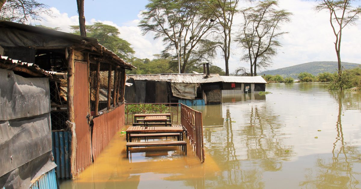
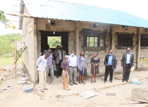
At least 75,987 households and 61,723 hectares of agricultural land have been adversely affected by rising water levels in Lakes within Rift Valley.
Losses caused by the rising waters run into billions as households lost their homes, sources of livelihood and some large scale farms were forced to either shut down or downscale their operations following increased water levels.
Tourist hotels in some areas such as Lake Bogoria and Naivasha have also been forced to stop operations after their entire investments were swallowed up by the waters that seem to offer no respite.
Government Spokesperson Colonel (Retired) Cyrus Oguna observed that besides the concerns raised by the lakes, the government was also concerned about the fate of the Turkwell dam which threatens to spill over its waters.
He noted that current water levels at Turkwel dam had risen to 1140 meters, an equivalent of 92 percent of the reservoirs maximum capacity and 9 meters higher than ever recorded, leaving only 1.60 meters before it spills over into the exit canals and the spill-ways.
He said the rising waters in the dam were exposing Lobokat, Kaputir, Katilu, Lobei-Kotaruk, Turkwel, township, Kanamkemer, Kerio and Kangatotha wards along the Turkwel basin in Turkana County to flooding.
Col. (Rtd) Oguna said the increased water volumes had destroyed schools, trading centres, health facilities, roads and farm lands in Baringo, Nakuru, Elgeyo Marakwet and Turkana Counties.
While giving an update on the status of rising water levels in Lakes Nakuru, Turkana, Elementaita, Baringo, Bogoria, Magadi and Naivasha, Oguna said a task force appointed by the Ministry of Environment to establish the possible causes of the phenomenon had finalised its work and was compiling a report.
The mystery behind the surging volumes in the water bodies is baffling considering that in 2009 Lake Elementaita was declared to be on its death bed with more than 80 percent of it having dried up, while Lake Nakuru shrank by more than 50 percent at the time.
Lake Nakuru has swollen and spilled into neighbouring farms walloping more than 100 acres of farmland and displacing more than 600 families on its Eastern shores of Mwariki Village.
Lake Naivasha has completely submerged Kamere Fish Landing Beach with its waters flooding Kihoto and Kasarani Estates. It has also expanded its shoreline and merged with the smaller Lake Oloiden.
Scores of jobs have been lost in the horticultural sector that has already taken a severe beating following the outbreak of Covid-19, after water flooded into and completely submerged more than six flower farms along the shores of Lake Naivasha.
At Lake Elementaita the gradual rise in water levels in the past four years has had a significant negative impact on congregatory bird species populations.
Lake Elementaita has been a critical breeding ground for the Great White Pelicans, has over 450 species of birds and is a haven for thousands of Greater and Lesser flamingos that once upon a time flocked the lake during favorable weather conditions.
Pelicans’ breeding islands are totally submerged while flamingos have migrated out in pursuit of concentrated alkaline waters where their food production is sufficient. The Lake’s famed hot springs have also died out.
Colonel (Rtd) Oguna said the water levels in lakes Nakuru, Naivasha and Elementaita have in the past eight months increased, recording levels superseding the 2012-2013 records, when they experienced a major increase.
The multi-agency task force, chaired by Environment PS Dr. Chris Kiptoo, constitutes experts in natural resource management, climate change management, disaster management, geology, hydrology and social economy among others.
It was expected to undertake environmental scooping of the social and economic impacts of the rising water levels.
Dr. Kiptoo added that though his Ministry has deployed geologists and seismologists to conduct comprehensive research to establish the exact cause of the phenomenon, the increase might be due to geographical activities more than rainfall patterns in the region.
“All lakes in Kenya’s Rift Valley have risen since 2011, to levels not seen in the last 50 years. These include Naivasha, Elementaita, Nakuru, Bogoria, Baringo, and Logipi.
There is no denying that the rise of lakes poses a great risk to our lifestyles, environment and economy,” observed the Principal Secretary.
Dr. Kiptoo stated that only conclusive scientific studies will confirm whether the rise in the water level of the lakes in Rift Valley is due to effects of regional tectonics influenced by the movements of global earth’s plate tectonics.
Kenya Wildlife Service Central Rift Regional Conservation Coordinator Dickson Ritan observed that five seasonal rivers namely Njoro, Makalia, Nderit, Naishi and Larmudiak which feed Lake Nakuru and flow from either the Mau Escarpment or the Aberdares have also recorded increased levels of water during the period.
He said studies conducted in 2016 in some of the three Lakes’ catchment areas suggested that a phenomenon known as The Indian Ocean Dipole (IOD), also known as the Indian Niño, which was causing record-breaking temperature changes in the Indian Ocean surface, was one of the factors contributing to the increase in lakes’ water levels.
Ritan observed that the situation was not confined to Lakes within Rift Valley or Kenya as other water bodies in East Africa countries were also registering rising levels.
“Scientists now believe that IOD has also contributed to surging water levels in Lakes within East African Countries that surround the Indian Ocean Basin, and is a significant contributor to rainfall variability in this region. The rise in waters is being experienced even in Lakes outside Rift Valley and Kenya. However more conclusive studies need to be undertaken to establish the main cause” observed Ritan.
He noted Lake Nakuru has now completely submerged some old buildings that had been abandoned in 2013, when the lake swelled.
Ritan stated that the Lake area has increased by 20 square kilometers within the past ten years and risen from an average of 3 metres to ten meters in depth.
Col (Rtd) Oguna revealed that increased water levels had collectively submerged 755 square kilometres of arable and riparian land.
The government spokesperson noted that while Lake Baringo covered an area of 152km in 2010, it currently occupies an area of 286 km, an increase of 86 percent while Lake Magadi had registered the lowest increase after its waters expanded from 124 km in 2010 to the current 129, denoting a 4 percent increase.
Col. (Rtd.) Oguna noted that the rise, besides displacing thousands of families had also completely destroyed infrastructure in the affected areas while wildlife habitats had greatly diminished. This, he noted, was expected to increase the intensity of the human wildlife conflict in coming days.
By Jane Ngugi/Dennis Rasto


