The government is in the process of upgrading the Kenya Institute of Surveying and Mapping (KIMS) to a Semi-Autonomous Government Agency (SAGA) with the aim of hastening decision-making, policy formulation, and implementation to improve the performance of the institute.
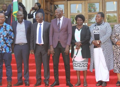
State Department for Land and Physical Planning Principal Secretary (PS) Nixon Korir, who graced the 13th graduation ceremony of KIMS on Friday, said that the institute has been a focal point in the transfer of Geo-information knowledge within the East, Central, and Southern Africa regions.
“Geo-information is necessary for addressing national and cross-border issues in the continued management and conservation of our resources for sustainable development and poverty alleviation,” PS Korir emphasized.
He encouraged the Institute to establish links with leading organizations in emerging trends in Geo-information technologies, such as drone mapping.
Speaking at the event, the PS stated that KISM is a Centre of Excellence as 2,559 students have graduated from the institution since its inception. Another 457 students were awarded diplomas and certificates in yesterday’s graduation.
The PS added that due to the demand for the courses offered in KISM, the student population has grown to over 700 students in session, and in order to cater for the increasing student population, the government will construct an extra three storey tuition block to commence in the financial year 2023-2024.
“With this building completed, KISM will have the capacity to accommodate two thousand five hundred (2,500) trainees per session. This is also in line with the government’s policy to ensure 100 per cent transition for our learners at all levels of education,” voiced Korir.
Additionally, he stated that there is a shortage of lecturers, especially in the core teaching Departments in the institution and thus the ministry is considering recruiting and transferring resource persons from other sections within the State Department to bridge this gap.
Meanwhile, the PS highlighted that KISM has also collaborated with the Kenya International Boundaries Office (KIBO) to train staff from Kenya, Tanzania, and South Sudan in short courses to empower them to reaffirm and map their common international boundaries.
Korir added that KISM is a Centre of Excellence in the Northern Corridor Integration Project (NCIP) involving Kenya, Uganda, Rwanda, and South Sudan in the human capacity cluster.
He congratulated the graduates, noting that they are now trained, qualified, and equipped to serve the nation with the knowledge and skills acquired in the various geo-spatial and related fields of surveying and mapping.
By Emma Jolly Wambui


