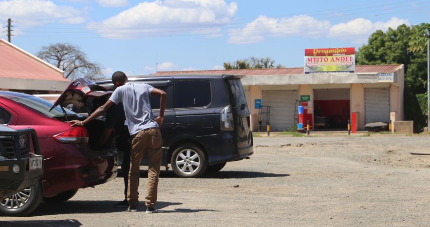
It has become the unofficial pilgrimage site for thousands of travelers plying the Nairobi-Mombasa Highway. From buses to trucks to private vehicles, there exists an unwritten highway tradition that involves a brief stopover at Mtito Andei Township.
Tucked on the rugged edge of Tsavo National Park, Mtito Andei is arguably the most famous center along the highway. Decades of vibrant road activities transformed it into a 24-hour economic hub. It is a haven for road users from the monotony and bone-breaking fatigue of traversing the 480-km stretch between the two major Kenyan cities. Mtito never sleeps.

Whether at night or during the day, this fast-growing center purrs with life. There is food for hungry stomachs, water for parched throats and lodges to offer secure places for disheveled travelers to freshen up.
“Mtito Andei is as old as the highway. As the most famous stop between Nairobi and Mombasa cities, it will soon become the biggest highway town in future” predicts Mr. Alex Mbau, a veteran trader at Mtito Andei.
This prediction has merit. Though other highway centers serve road users, Mtito has a competitive edge due to her strategic location. With the surge of Mombasa port activities and land, Mtito is expected to grow and serve the needs of the burgeoning highway population while generating millions of shillings.
However, underneath this vibrant outlook, there lies a troubled underbelly resulting from disputed ownership. Located at the boundary of Makueni and Taita-Taveta counties, both counties have been on each other’s throats over who actually owns Mtito.
“This row is about revenue and resources. Taita-Taveta swears Mtito falls within her boundary. Makueni says the town is hers. The truth has become very murky,” adds Mr. Mbau.
The once mundane dispute has now morphed into a huge political landmine that teeters on the verge of turning violent. The antagonism is now a culture. In December last year, officials from Taita-Taveta County had to flee after hostile youths from Makueni stormed a public participation meeting at Mtito to gather views on County Integrated Development Plan (CIDP) 3. In 2015, a senior Taita-Taveta trade official was chased away by angry traders when he led a revenue team to charge business permits at Mtito.
Governor Andrew Mwadime labels such acts of aggression as unfortunate. He says that though the Council of Governors has taken up the matter, there is a court order directing Taita-Taveta to issue business permits at Mtito Andei. In the order issued by Justice Lucas Naikuni of Mombasa Environment and Land Court on 20th September 2021, the court appointed Taita-Taveta County as the sole authority to issue licenses and levy taxes at Mtito Andei. The revenue will be deposited in a revenue account jointly opened by both county governments.
This order implies Taita-Taveta County has the rightful claim over Mtito-Andei.
“The court gave us the nod to collect the revenue from Mtito Andei. We are complying with that order,” said the governor.
However, continuous saber-rattling by local leaders and politics of grandstanding by both counties have only made a delicate situation more precarious. Even with the order, Taita-Taveta has not collected a single coin due to the hostility encountered from traders and residents.
Mr. Leonard Lagat, Taita-Taveta Finance Chief officer, says they will go back to court citing.
“By barring us from collecting revenues, this is disobedience of a valid court order. That is contempt,” he said.
During Jamhuri Day celebrations last year, Makueni Governor stirred the pot when he reiterated Mtito Andei was within Makueni County and would not cede an inch. The governor would later, in a terse online exchange, ask Taita-Taveta Senator Johnes Mwaruma to make public the report by former Cabinet Secretary for Lands Ms. Farida Karoney over this incendiary boundary issue.
In 2021, Senator Mwaruma had asked for the accuracy of information over the actual location of the boundary between Taita-Taveta and Makueni counties.
In her response, CS Karoney said the boundary dispute resulted from unclear description of the common boundary as per the District and Province Act (No. 11 of 92). The act, she noted, cited Mtito Andei as being in both Taita-Taveta and Makueni counties.
“There is confusion on boundary description which site (sic) Mtito Andei as being in both Makueni and Taita-Taveta Counties,” reads Annexure 3 of the CS’s response.
However, the Chairperson of the Electoral Commission had issued a legal Notice No. 14 of 2012 stating that Mtito Andei location of Kibwezi East Constituency is in Makueni County. Such contradictory statements from the government have exacerbated the confusion and contributed to mounting hostilities between residents of the two counties.
Mtito Andei ex-chief Mr. Paschall Kyulle says Mtito Andei falls under Makueni County. He adds that before devolution, public services at Mtito Andei including garbage collection were done by the defunct Machakos County Council.
He accused political leaders in the 90’s of tampering with the boundaries attributing the confusion in official records to haste in doing an illegality.
“A very powerful KANU minister from Taita was behind this plot. Everything was done in a hurry. This brought more confusion to the whole boundary matter,” he says.
However, former Taita-Taveta County Council chairperson Arresmus Mwarabu says the county council collected rates from Mtito in the 70’s. Overtime, laxity crept in and Makueni stepped in to claim the township. He notes that in the 1970s, Mzee Jomo Kenyatta would be officially welcomed to Coast province by Provincial Commissioners at Mtito Andei.
“Former Coast regions PCs received the head of state at Mtito Andei. This was the boundary between Coast and Eastern provinces,” he said.
Historical records indicate Mtito Andei boundary row has been festering from as far back as the 1960’s. In a letter dated 4th august 1962 addressed to Secretary for Regional Boundaries and Constituencies Delimitation Commission through the District Commissioner of Taita District, a committee comprised of senior politicians from KANU and KADU parties had demanded alteration of boundary that erroneously placed it at Tsavo River.
The committee was chaired by Mr. Laban Shuma, chair of Area Development Council (ADC) and counsellor for Mbale. Other members were E.L Msamuli, ADC Vice Chair, ex-chief Johana Mwanyolo, an elder, Canon S. Kiteto, a church minister and V.N Ludindi, chair of Taita Welfare Organizations amongst others. The committee agreed the proper boundary should be at Mtito Andei.
“By right, our district should go as far as Mtito Andei and not Tsavo as in the present maps,” reads part of their resolution.
The proof provided by the committee was that Taitas hunted at Mtito Andei and basket weavers obtained fiber for making vidasi (baskets) from the same area. Arab traders also used to buy ivory from Taitas who got it from Mtito Andei. Apart from this dispute, Taita-Taveta County also has another simmering boundary row with Kwale County over the ownership of Mackinnon Township.
“The government should make clear where the actual boundary is to avoid all this confusion,” says Ms. Purity Ngaamu, a tomato hawker at Mtito.
By Wagema Mwangi


