The County Government of Nakuru is in the process of establishing a Geospatial Information System (GIS) laboratory in order to help the devolved unit in collection of data digitally and improve on its development agenda.
The devolved unit’s administration has indicated that the GIS system being developed with support from the World Bank will help in getting information on the varieties of natural resources in the county and the social facilities available adding that it will also help in management of human resources.
Chief Officer for Lands and Physical Planning, Ms Stella Mwaura, elaborated that the GIS laboratory system will further help local and foreign investors to conveniently access land information.
While noting that setting up of the GIS laboratory was in line with Governor Susan Kihika’s manifesto to digitize access to some essential services to shorten the time and reduce the cost of access to services, Ms Mwaura added that the system will help them collect, process and analyze data in digital form.
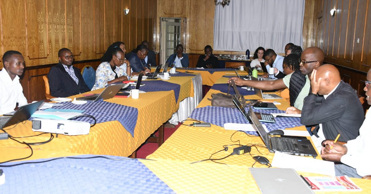
She made the remarks when a delegation from the World Bank met with officials from the County Department of Lands and Physical Planning, and the State Department of Housing and Urban Development for an engagement session to assess the Geospatial data needs and potential support areas within the Municipal Spatial Data Infrastructure (MSDI).
Highlighting the transformative power of GIS, and its critical role in urban planning, tackling encroachments, and in promoting public feedback Ms Mwaura said she was hopeful that the GIS laboratory system will improve development planning and management.
The GIS lab is expected to provide a platform to store and manage digital footprint of development projects in sectors such as water, education, health, roads, rangelands, environment and natural resources.
Clause 105 (f) of the County Government Act 2012 requires county governments to establish GIS-based database systems for provision of data in the development of the County Integrated Development Plan (CIDP).
The technology is important for decision making during planning and allocation of resources for the Annual Development Plan (ADP).
Ms Mwaura noted that in Africa geospatial technology is necessary because the continent still faces numerous challenges such as unplanned settlements, degraded rangelands, inadequate or unplanned infrastructure, low quality of development projects, poor monitoring systems, mushrooming of new settlements and inequitable resource allocation due to lack of appropriate tools for decision making.
“We have resolved to use GIS technology cognizant of these challenges and the need to streamline monitoring of development projects and ensure equitable resource allocations based on evidence,” the Chief Officer explained.
GIS uses location-based data collected via satellites, paper maps, and directly from the field through mobile positioning devices to map out resources for analysis and decision-making.
The Chief Officer said the technology will help the county government in supporting prudent management and allocation of resources while also facilitating rational decision-making processes.
By using geographic information, she pointed out, the county government will be able to make informed decisions when it comes to planning and distributing projects equitably.
“The system enables any government to make key decisions that enable development in all areas without discrimination. The Geospatial Technologies Services laboratory stores data for all projects done by the county and also helps in monitoring projects being implemented. The technology provides the GIS with images frequently to help closely monitor ongoing development projects in the county,” she explained.
She went on “This satellite technology will enable us to monitor our programmes and thus ensure their implementation. It is one way of automating services with the aim of improving efficiency as well as sealing loopholes through which public funds are lost.”
The County Government is optimistic that the technology will help in supporting prudent management and allocation of resources while also facilitating rational decision-making processes.
The technology can identify areas in dire need of road connection or department that requires urgent support in terms of funding among other things.
It can also be used to enhance various social amenities such as schools, hospitals, dispensaries and markets.
The system can also help streamline the budgeting process and give evidence-based development needs to the people, thereby attracting support from development partners according to the official.
Ms Mwaura said GIS will help the county administration to manage resources efficiently and effectively for the benefit of the residents including forest areas, water, minerals, wildlife, and wetlands through developed spatial plans.
“GIS offers a clear look into issues affecting the residents and comes in handy in implementing policy framework and enhanced feedback. Most people may not know but GIS and its utilization and implementation is part of Governor Kihika’s manifesto,” noted the Chief Officer.
The GIS lab is expected to provide a platform to store and manage digital footprint of development projects in sectors such as water, education, health, roads, rangelands, environment and natural resources.
By Anne Mwale


