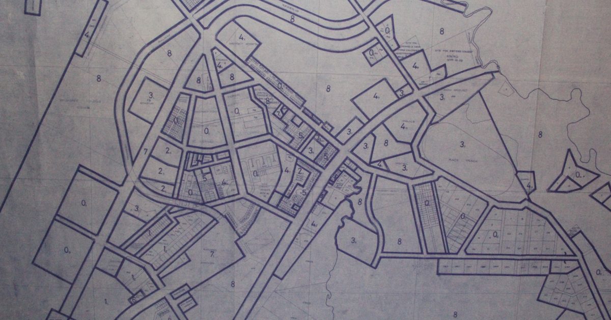
A myth is told of how the map guiding engineers constructing the Nairobi-Nanyuki metre gauge railway in 1930 got lost as they made merry in Nanyuki town, thus effectively cutting short the progression of the railway to Northern Kenya.
However, the myth has been shattered by lands officials in Laikipia after they produced what they claim is the original map that clearly indicates there had been an intention to extend the railway line beyond the Nanyuki terminus towards Meru and Isiolo.
Laikipia National Land Coordinator Josphat Wasua recently produced the newly found map at a multi-agency consultative forum that is seeking to streamline land and natural resources issues in Laikipia County.
The tale of the lost railway route map has always defined Nanyuki town as an entertainment hotspot nationally and internationally almost to the class of Las Vegas. It tells of how engineers constructing the 250- kilometre Nairobi- Nanyuki railway got trapped and carried away by merry and fun that characterizes the town and in the process lost the map.
With nothing to show them the route the railway line was to take, further construction of this critical infrastructure hit a dead end. This earned Nanyuki the nickname Mwisho wa Reli (end of the railway).
Among those at the forum was the Governor Ndiritu Muriithi, County commissioner Daniel Nyameti, County Assembly Speaker Patrick Waigwa, MCAs, among other representatives from National Environment Management Authority (NEMA), Water Resources Authority, and Urban Planning.
Wasua said the map dated 1968 shows the line beyond its current terminus cutting through Nanyuki town, crossing the Lunatic lane just opposite the police station, Likii River and onwards to Meru.
The participants discussed at length various issues touching on the history of physical planning, the extent of violations on original plans, and the social-economic and environmental impact of the encroachments in Laikipia and beyond.
The meeting also sought to understand the legal aspects that guide land use as well as classification.
The forum is seeking sustainable solutions regarding land questions in the county. In particular, the thorny issues of irregular land titling, abuse of allotment letters, and the reclaiming of public land, wetlands, water sources, and riparian from private ownership were addressed.

The team is seeking a coordinated approach to solving issues of encroachment, land grabbing and violations of land plans through a streamlined framework that ensures adherence to the laid down regulations.
Wasua also displayed another 1991 map that is purported to have replaced the original map of 1968. This 1991 map did not have the development of the railway line beyond its Nanyuki terminal. Fortunately, the map does not have a disclaimer on its Legend to the effect that it supersedes the original map of 1968.
“The 1991 Map is null and void because it does not supersede the one of 1968,” declared Wasua.
This does not bode well for developments that were based on the false 1991 map. A group of encroachers have already gone to court to prevent the Kenya Railways from recovering its grabbed land around Nanyuki.
Revelations about the map have coincided with Nanyuki centenary celebrations as well as the revival of the Nairobi-Nanyuki railway. The broader vision of the project is to connect the capital city with the Lapsset corridor at the designated Resort City of Isiolo and to the huge economies of South Sudan and Ethiopia. The Kenya Railways has a big warehouse in Meru town.
It has emerged that the original Nanyuki map was altered and existing regulations grossly abused to pave way for a series of irregularities. The original map also features a 90-metre wide road reserve for a dual carriageway, the main transport corridor linking the City to the Lapsset Corridor in the north.
Alterations in subsequent maps have greatly interfered with the original town plans and paved the way to an unregulated town development and encroachment on public land and infrastructure spaces.
The town is expanding rapidly while developments are violating the law, as evidenced by more high-rise residential flats coming up in areas designated for single dwellings.
By Martin Munyi


