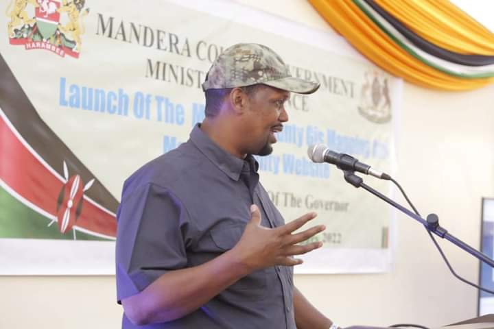
Mandera County government has launched a digital website platform and Geographical Information System (GIS).The website will enhance service delivery in the county, while the GIS will be important in capturing, storing, checking, and displaying data related to positions on Earth’s surface.
The Mandera website will provides a platform where people can access critical information about the county including development projects, progress reports, county Integrated development plans and budget estimates. It also features news and has embedded videos with valuable information for public consumption.
When launching the two programmes at Mandera County headquarters, area Governor Ali Roba stated that the website serves is a mirror to the world that provides information on the County’s history, organizational values, codes of ethics, activities and achievements of key ministries and departments, as well as information regarding elected officials and senior county staff.
He added that the website will help collaborate inter departmental coordination while database from GIS will help in locating places in the county.
“The website will act as a platform where the world get to know Mandera County well, it will also collaborate inter departmental coordination making service delivery easy, “said Roba.
Roba said all departments will avail their information to the website for easier coordination by the executive wing of the county government.
He added that the website will provide an opportunity for online services like payment of bills, accessing business licenses, tenders and job applications as well as allowing public to tender their views, opinions and inputs on different projects.
“I am asking our members of public to be regular users of the website to access critical information about county, development plans can be accessed as well as open business opportunities for our youth and women who seek to participate in tenders advertised online. It is on this website that the Mandera County Public Service Board advertises employment opportunities,” said Roba.
Roba also stated that the main aim of Mandera GIS is to map and visualize Mandera County’s geospatial data using Google Maps platform which will provide layout of roads, the locations of cities, towns and villages, state boundaries, geographical features, restaurant reviews and satellite images. This will enhance the ability to check possible routes and landmarks for faster travel time.
“Geographical Information System will store database for managing geographical data, the Google maps will further help people to know layout of roads for traveling arrangements,” said Roba.
Mandera County ICT Chief Officer Pheinus Mohammed urged all heads of departments to share information with ICT department to be updated for public consumption.
She said her department has deployed an ICT manager that will check on the website and help it serve its purpose. She added that the website will enhance financial accountability and increase collection from its businesses.
By Charles Matacho


